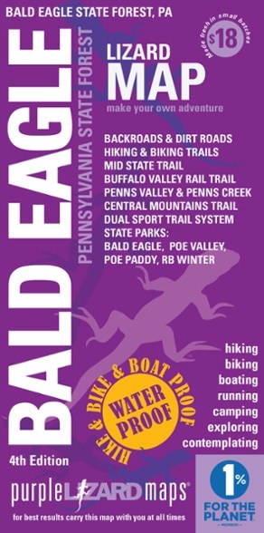
Purple Lizard Maps Bald Eagle Pennsylvania State Forest Map - 4th Edition
This product is not available.
A map for people who love real-world experiences, the 4th edition of the Purple Lizard Maps Bald Eagle Pennsylvania State Forest map will help you plan your adventures in and around the area.
Shop similar products- Durable, waterproof map opens to 24 x 36 in. and folds to 4 x 8 in. to fit in your back pocket
- Includes both latitude/longitude and UTM coordinate systems
- Indicates which roads are paved, dirt/gravel or 4WD roads as well as which are gated closed to motorized use
- Highlights designated public trails and paths including hiking, biking, equestrian, skiing and rail trails
- Includes points of interest such as campgrounds, picnic areas, climbing areas, over 60 numbered, reservable car camping sites, scenic overlooks and observation towers
- Little purple lizards scattered on the map signify an interesting spot to check out—could be a cool place, sweet view or local legend
Made in USA.
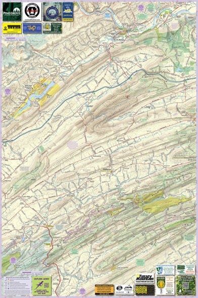
A beautifully designed, easy-to-read topographic map featuring contour lines, elevation data, shaded relief and all the key details you need to plan your adventures: backroads and trails, trail use designations, road surfaces (paved/gravel/4wd), parking access, campsites, public lands, historic sites and more.
Public land includes over 195,000 acres of Bald Eagle State Forest, parts of Rothrock and Tiadaghton State Forests, as well as Poe Valley, Poe Paddy, Reeds Gap, RB Winter, Ravensburg, Milton, Sand Bridge, McCall Dam and Bald Eagle State Parks, and parts of State Game Lands 295, 317, 323, 255. Destinations include fly fishing on White Deer Creek and Penn's Creek, the Poe Valley and Poe Paddy State Parks, and countless hiking and biking trails in this very remote part of the Pennsylvania mountains.
323-mile Mid State Trail (MST) shown from Woolrich, PA to the MST Tunnel under Route 322 at Seven Mountains. The MST continues on both the Purple Lizard Rothrock and Pine Creek Lizard Maps (not included). Bald Eagle has a tremendous amount of mountain bike trails which is one reason it has been the location for the Wilderness 101 and Trans-Sylvania Epic Stage Race for many years.
The Central Mountains Trail System is a network of shared use trails in the RB Winter State Park area. The Buffalo Valley Rail Trail is a 9-mile path between the towns of Lewisburg and Mifflinburg. The very popular unPAved gravel bike event is held entirely on this map.
For paddlers, the Susquehanna River Trail is shown from mile 3 to mile 19 on the West Branch at Lewisburg, PA. The Seven Mountains Dual Sport Trail is included, which is open seasonally for licensed motorcycles, along with the Shade Mountain Off Highway Motorcycle Trail (OHM) which is open seasonally for off-road motorcycles. The East Kettle ATV Trail at Jack's Mountain is shown.
Natural areas and points of interest include the Penn's Creek Wild Area, Tall Timbers Natural Area, Snyder Middleswarth Natural Area, Rosecrans Bog Natural Area, Halfway Run Natural Area, The Hook Natural Area, Walker Lake and Lock Haven City Authority land. Also shows the towns of Avis, Beaver Springs, Centre Hall, Howard, Lewisburg, Lock Haven, Madisonburg, Middleburg, Mifflinburg, Millheim, Milroy, Milton, New Berlin, Penn's Creek, Rebersburg, Selinsgrove, Spring Mills and Potters Mills, PA.
| Best Use | Hiking Mountain Biking Travel |
|---|---|
| State / Province | Pennsylvania |
| Folded Dimensions | 8 x 4 inches |
| Unfolded Dimensions | 36 x 24 inches |
| Map Scale | 1:63,030 |
| Double Sided | Yes |
| Waterproof | Yes |
| Publisher | Purple Lizard Maps |
| Copyright Year | 2022 |
Be the first to write a review!
Adding a review will require a valid email for verification

