One of the crown jewels of California, Yosemite National Park boasts spectacular granite peaks, iconic waterfalls, giant sequoia trees, verdant meadows and pristine rivers and streams.
Established in 1890, it’s one of America’s oldest national parks, and with millions of visitors flocking there each year, it’s also one of the busiest.
Activities like camping, day hiking, backpacking and bicycling all await you here; and of course, Yosemite is also a world-class rock climbing destination.
To help sort through your options for exploring, we asked Jordan Franco, a sales manager at the REI Fresno, California, store, to share a few of his favorites. REI Adventures Yosemite Guide Tyler Gates and REI Adventures Yosemite Programs Director Chris Rickert also shared some of their secrets for this article.

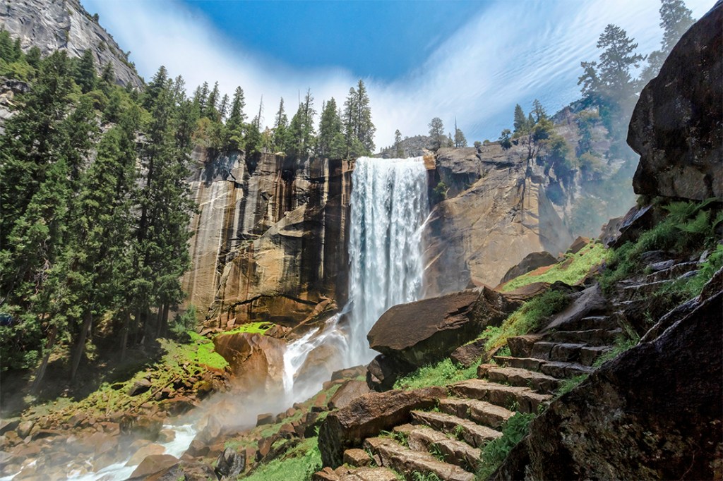
Yosemite’s Vernal Falls—on the popular Mist Trail—covers nearby granite in spray.
Camping in Yosemite
The park has 13 car-accessible campgrounds, offering more than 1,400 total campsites. Seven of the campgrounds offer reservable spaces and seven campgrounds offer sites on a first-come, first-served basis. Tuolumne Meadows, the biggest campground, sets aside half of its 304 sites for reservations and the other half of its sites for first-come, first-served campers.
Reservations: Campgrounds requiring reservations are usually full from around April through September. The park’s campground reservations page provides details about how to maximize your chances of getting one.
You can reserve campgrounds by using the national Recreation.gov website or by calling 877-444-6777. Note that some reservable campgrounds are available on a first-come, first-served basis outside of peak camping season.
Campgrounds in Yosemite Valley are jam-packed all summer and reservations are difficult to get. Below are a few alternatives that offer a quieter camping experience.
Crane Flat Campground (166 sites, reservation-only): Located about 30 minutes northwest of Yosemite Valley on Big Oak Flat Road (Highway 120), Crane Flat campground is away from the hustle and bustle of the main valley. Surrounded by trees and meadows, you are within a 5-minute drive of the Tuolumne Grove trailhead. Here you can meander for a mile or more through a stand of giant sequoias, one of the few sequoia groves in the park.
Wawona Campground (93 sites, reservation-only during peak season): Located more than 25 miles south of Yosemite Valley on Wawona Road (Highway 41), Wawona campground also offers a less hectic camping experience than campgrounds in the main valley. On the bank of the South Fork of the Merced River, you are within a short drive of the Mariposa Grove’s giant sequoias (though that area is closed for restoration until the spring of 2017). You are also close to the trailhead for the Chilnualna Falls day hike and Buena Vista Lakes backpack, both described in the hiking and backpacking section below.
White Wolf Campground (166 sites, first-come, first-served): Located Off the Tioga Road (Highway 120) about one hour north of Yosemite Valley, White Wolf campground is higher than the main valley and nestled in a pine forest. A backpackers-only campground here lets wilderness permit holders spend the night before a trip, which is highly recommended if you’re doing the Grand Canyon of the Tuolumne backpacking trip, described below.
Hiking and Backpacking in Yosemite
Yosemite’s vast unspoiled backcountry—nearly 95 percent of the park is wilderness—makes it a prime destination for backpackers. Both the Pacific Crest Trail and the John Muir Trail wind their way through the park, each traversing sublime sections of Sierra Nevada high country.
Because all that splendor lures hikers from far and wide, you’ll need to carefully plan your itinerary to ensure you get the needed permits.
Backcountry permits: Anyone who spends a night in the backcountry is required to get a Wilderness Permit. Yosemite caps the number of hikers from each trailhead, so you’ll want to make reservations far ahead of time.
Reserve early: Reservations are available 26 weeks in advance when the permit office is open (late November through October). Although popular trailheads may fill up, there is almost always space available at other trailheads in the park. From November through April, wilderness permits are available without a reservation.
If you must procrastinate: Each trailhead has 40 percent of its daily quota set aside on a first-come, first-served basis. For all trailheads, permits are issued starting at 11 a.m. the day before a hike.
John Muir Trail (JMT) permits: Hikers looking to trek the 211-mile trail need a special permit, of which only 45 are available daily. Check out our JMT packing list for more details.
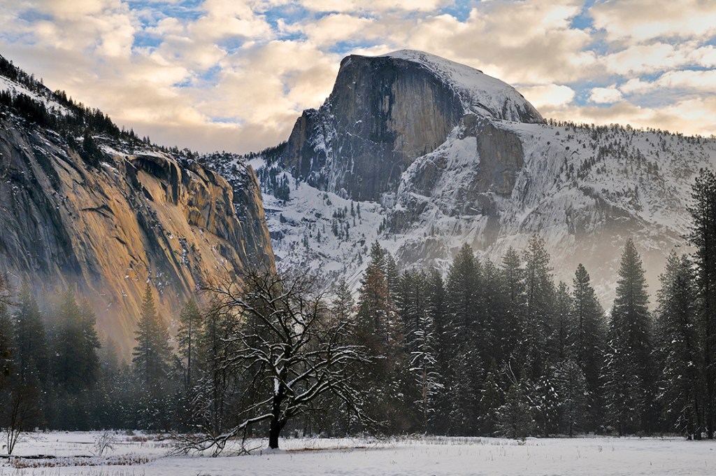
Half Dome permits: The granite monolith is so beloved that the park service now requires a Half Dome permit for both day hikers and backpackers. If your plan includes Half Dome, you must specify that on your wilderness permit application.

Scaling Half Dome is a bucket-list hike, but you’ll need a permit.
Half Dome day hiking permits are tougher to come by, so consider a short overnighter if your desired date isn’t available. And, if you’re planning a multiday trip that starts or ends near Half Dome, that’s a great opportunity to add it to your itinerary.
Recommended Hikes
Hetch Hetchy’s Wapama Falls Day Hike (easy; 5 miles round-trip): Though dammed years ago to form a reservoir for San Francisco, Hetch Hetchy nonetheless feels like a smaller version of Yosemite Valley. Serene lakes lie within massive granite bowls, surrounded by soaring peaks. Northwest of the main park entrance, this area attracts far fewer visitors than the main valley.
During peak flows, Wapama Falls is a phenomenal torrent, as well as a short, sweet day hike. The falls are next to a small bridge that gets overrun when its waters run extremely high, so it’s best to skip this hike during a severe storm.
The hike begins at O’Shaughnessy Dam. To reach the trailhead, cross the dam and walk through a tunnel. The trail goes up and down as it follows the shoreline of the reservoir. You’ll pass lovely Tueeulala Falls, which runs high in spring and dry in late summer, before you reach your destination. Wapama Falls plunges 1,300 feet as it thunders down Falls Creek toward the reservoir.
Hetch Hetchy’s Rancheria Falls Day Hike (moderate; 13.4 miles round-trip): This trail is an extension of the Wapama Falls trail, above. Though it’s more than 10 miles round-trip, the trail itself is not particularly challenging.
This low-elevation hike bakes you during the summer, so pack plenty of sunscreen. And pack water for the hot, dry climb after Wapama Falls. Slabs of glistening granite and a cascading chute of water make this a rewarding destination.
Wawona’s Chilnualna Falls Day Hike (moderate; 10 miles round-trip): Situated south of Yosemite Valley, Wawona is a low-elevation, meadow-rich area that serves as a less traveled gateway into Yosemite.
The park service lists Chilnualna Falls as the second highest waterfall in Yosemite, but it’s by no means the second most visited. This lesser known giant is accessed from a parking lot that’s two miles up Chilnualna Falls Road, which is accessed near the historic Wawona Hotel. The hike is rated “moderate” purely because of the continuous elevation gain: 2,400 feet in all.
The trail follows Chilnualna Creek for a half mile. Switchbacks then lead you away from the creek into the open forest, where you are treated to views of the Wawona area. Your steady climb up a well-maintained trail reaches the turnaround point where upper Chilnualna Falls pour over the edge. Onlookers can enjoy a refreshing mist, though a jumbled rockscape hides much of the falls. On the way down you’ll be rewarded with alternative views of the lower sections of the falls.
Glacier Point’s Pohono Day Hike (strenuous; 13 miles one way): This highly recommended trail departs from the bustling lookout on Glacier Point. If you leave one vehicle at the parking area on Route 41N just before entering the valley floor and drive another vehicle to the Glacier Point parking lot, you can enjoy a mostly downhill trek with dramatic vistas throughout the journey. (If you choose to hike this trail the other direction, you’ll be faced with a 2,800-foot elevation gain.) Because the trail has so much sun exposure, it’s best to pick a cool day for this one.
The Pohono Trail snakes past precipitous drop-offs, offering stunning viewpoints of the Yosemite Valley. It’s a perspective that few park visitors get to enjoy. You’ll gawk at Glacier Point, Taft Point, Dewey Point, Crocker Point, Stanford Point and Inspiration Point. The trail ends at Tunnel View—the name was inspired by an iconic scene that’s perfectly framed for drivers approaching Yosemite Valley.
Tioga Road’s Cathedral Lakes Backpack (easy; 7 miles round-trip): The trailhead for this trip is one half-mile west of the Tuolumne Visitor Center. In the summer (June through late September) you can take a free bus out of Yosemite Valley to and from the trailhead.

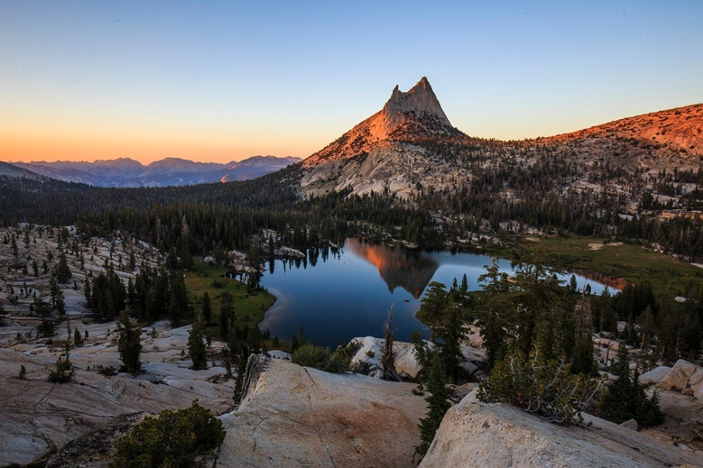
The sunset illuminates Cathedral Peak in the Yosemite backcountry.
The Cathedral Lakes Trail climbs steeply for a few miles then winds down into a lake basin. Near the top of the climb, it passes a spur trail to Lower Cathedral Lake (a half-mile side trip). Upper Cathedral Lake, a gorgeous alpine pool overlooked by the towering spire of Cathedral Peak, is a prime example of Yosemite wilderness. A beautiful trail circles the lake and nearby peaks offer a variety of scrambling possibilities.
Tioga Road’s Grand Canyon of the Tuolumne Backpack (moderate; 30+ miles one way): This 3- to 4-day trek requires a steep drop to the Tuolumne River in Pate Canyon to start and a substantial climb up to Tuolumne Meadows at the end. Though you actually have to gain more elevation if you start at White Wolf Campground, described above in the camping section, this is the preferred direction. At the end of the trip, you can take the hiker’s shuttle bus back to White Wolf. And if you miss your planned shuttle, you’ll have many chances to hitch a ride back from the busy Tuolumne Meadows area. Alternatively, you and a hiking partner can park a car at White Wolf and at the Lembert Dome parking area in Tuolumne Meadows.
The trip takes you past numerous waterfalls along the Tuolumne, as well as a number of tempting backcountry swimming holes. It also merges with the Pacific Crest Trail for the final stretch: from the aptly named Glen Aulin (Gaelic for “beautiful valley”) back up to Tuolumne Meadows.
Wawona’s Buena Vista Lake Backpack (strenuous; 30+ miles round-trip): This is an extension of the Chilnualna Falls day hike, described above. Because of the continuous elevation gain, it makes a strenuous adventure that is best broken up over two nights. Your elevation gain will be several thousand feet, with the final total depending on whether or not you choose to summit Buena Vista Peak.
The trailhead parking lot is two miles up Chilnualna Falls Road, which is accessed near the historic Wawona Hotel. The trail follows Chilnualna Creek for a half mile, then switchbacks up through open forest for another four-and-a-half miles to the upper falls, where the creek begins its rocky plunge.
The trail continues climbing, passing several higher elevation lakes. Consider spending one night at Royal Arches Lake and the next at Buena Vista Lake. On the second day you can also detour to scramble to the summit of Buena Vista Peak from Buena Vista Pass. Your final day’s hike reconnects with the Chilnualna Creek trail for the hike back down to the trailhead.
Other Ways to Explore Yosemite
On the water: Yosemite offers an abundance of places to swim, raft and fish. See the park’s water sports page for more details.
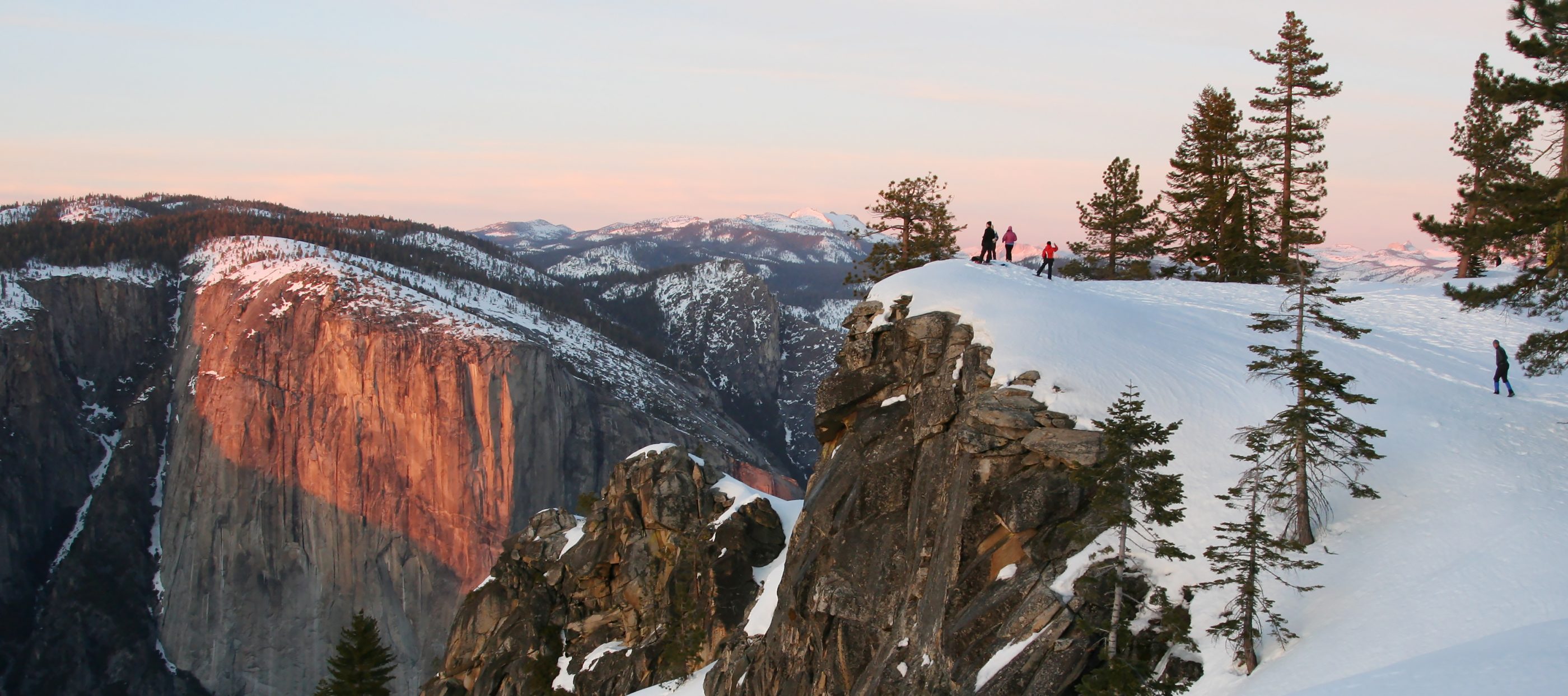
On the snow: When the park is blanketed in white, you have a rare opportunity to enjoy spectacular landscapes and solitude when you go snowshoeing, cross-country skiing or even downhill skiing and snowboarding. See the park’s winter sports page for more details.
Preparing to Visit Yosemite
Getting to Yosemite
Located in the central part of California, Yosemite is some 200 miles from San Francisco, 160 miles from Sacramento and just under 100 miles from Fresno. See the driving directions page for information about getting to the park and for links to public transportation options.
Yosemite Fees and Passes
Fees for entering the park depend on the type of pass you choose and the size of your vehicle. You can opt for a single-use park pass (good for seven days). Other options include an annual parks pass, or the America the Beautiful Interagency Annual Pass that covers all national parks and federal fee areas. For full fee details visit the fees and passes page.
Weather, Road Conditions and Visiting Tips for Yosemite
Seasonal swings: Summers are warm and dry with most rain coming in afternoon thunderstorms. Some 95 percent of Yosemite’s precipitation falls from October through May and the park is typically blanketed in snow from November through May.
With elevations ranging from 2,000 to 13,000 feet, conditions vary dramatically. Foothills can be springlike when mountain passes are fully in the grip of winter. The higher you go, the colder and more temperamental the weather will become.

Weather in Yosemite can fluctuate—so come prepared! Half Dome in winter, Yosemite National Park.
Lightning: Summer is afternoon thunderstorm season in the Sierra. If you’re hiking, plan to be out of the high country before noon. For more tips, see the park’s lightning safety page.
Current conditions: To get the latest road updates and a link to the National Weather Service forecast check out the park’s current conditions page.
Strategies to avoid crowds: Consider a trip outside of the peak June through September season. Visit midweek rather than on a weekend. Hit the trail early in the day, before 10 a.m., to avoid throngs of day hikers. Visit more lonesome places like Hetch Hetchy or Wawona, because nearly every visitor heads for Yosemite Valley. Just about any destination outside the valley will reward you with greater solitude.
Leave your vehicle behind: This is a great way to avoid the park’s notoriously snarled roads, especially on a midsummer weekend. The park’s transportation page offers details about shuttle services inside the park and offers links to Yosemite Area Regional Transit System (YARTS) routes that serve the park.
Yosemite Guidebooks, Maps and Other Resources
Guidebooks and maps: Both are sold at REI stores in the region. Our Yosemite Backpacking Packing List also has a link for them. USGS maps are sold at Yosemite National Park visitor centers and wilderness information centers. The Yosemite Conservancy’s bookstore offers both guidebooks and maps for the park.
Other Resources: The park’s backpacking page offers trail descriptions and other helpful links. The park’s brochures page offers downloadable maps.
Lodging and Food
The park offers everything from backcountry ski huts to posh wood-beam lodges. Communities outside the park also offer lodging. Restaurants, snack bars and groceries are also found throughout the park. For reservation info (book well in advance) and other details, visit the park’s eating and sleeping page.
Special Concerns in Yosemite
Bears: Never leave any food, nor anything scented, in your car, tent or pack. Anything you put in your mouth, or on your skin or lips, needs to be secured. Most campgrounds provide bearproof food lockers. Bear canisters are mandatory in the backcountry and the park service recommends those that require a screwdriver for closure. If you use a Bear Vault™ container, do not remove a set of tabs to make it easier to open and close: Vaults modified this way have been breached by bears. See the park’s bear and food storage page for more details.
Marmots, squirrels and other rodents: They love more than your snacks. They also love the salt residue on sweaty trekking pole handles. Don’t leave either behind if you do a day hike away from your backcountry camp. And it’s wise to leave pack pockets open to ensure they don’t chew their way in just to see what’s inside.
Rattlesnakes: Prime habitat is under rocks, logs and woodpiles at any elevation up to 9,000 feet. Bites are rare and none have ever produced a fatality in the park. See the park’s rattlesnake page for more details.
Plague: Yes, it’s true. A few rodents in the western U.S. have it and people have contracted the disease in Yosemite. The park service closely monitors the plague situation and has treated some burrows to prevent its spread. For details see the park’s plague FAQ page.
