Where the lowland river valleys of central California rise up to meet the granite passes and snowcapped peaks of the Sierra Nevada, giants live. Capable of reaching heights of up to 310 feet tall, and with trunk diameters that could fill the width of a tennis court, the largest trees on Earth are incomprehensibly big.
In 1890, twenty-six years before the National Park Service was established, America’s second national park came into being. Its purpose was singular: to preserve and protect giant sequoias, Sequoiadendron giganteum, whose numbers were dwindling at a rapid pace due to massive logging operations that had begun some forty years earlier.
Today, Sequoia National Park (along with its contiguous neighbor, Kings Canyon National Park) welcomes adventurers who want to escape into the heart of California’s High Sierra region, where giant sequoias, granite domes, marble caves and alpine landscapes swirl together to create a truly unforgettable place.
Ready to start exploring the Land of Giants? Here’s what this guide will cover:
- Why Visit Sequoia National Park?
- The Top Destinations in Sequoia National Park
- The Top Outdoor Activities in Sequoia National Park
- How to Plan Your Trip
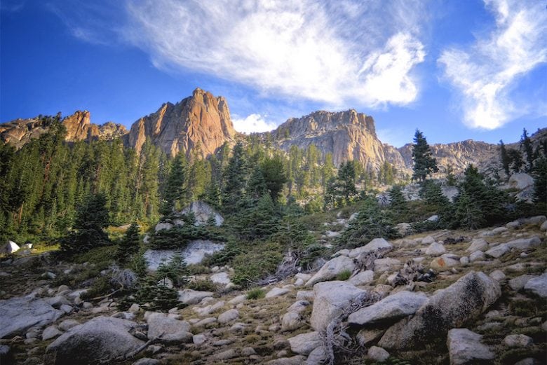
Horizontal slashes of light paint Sequoia National Park’s granitic peaks with an ethereal glow.
Why Visit Sequoia National Park?
Seeing the largest of anything conjures up images of kitschy roadside attractions like the world’s biggest frying pan, or a giant ball of string. Giant sequoias are not in that league. They are big on a scale that’s difficult to comprehend. Stand at the wall of bark that is their base and crane your neck to the sky. You won’t see the top, but you’ll probably feel as if you are shrinking, growing ever smaller beneath their outstretched branches. And the best part? Giant sequoias represent just a fraction of the park’s beauty.
Beyond the outstretched branches of giant sequoias, you’ll find river canyons guarded by massive granite domes, alpine meadows saturated with wildflowers, and rolling hills of chaparral and twisted blue oak. Marble caves invite explorers underground, sheer walls invite climbers to investigate new routes, and huge swaths of designated wilderness ensure the perfect spot to pitch your tent is just around the bend.
Epic routes, like the High Sierra Trail, lead hikers and backpackers along the Great Western Divide, revealing alpine lakes and the snowy peaks of the Sierra. And in the far east, Mount Whitney’s peak stands against the rising sun as the tallest point in the lower 48.
The Top Destinations in Sequoia National Park
Sequoia is divided into four main areas: Foothills, Mineral King, the Giant Forest and Lodgepole. These primary areas are the perfect spots to base your trips from, and where most of the park’s trails, lookouts and visitor centers are located.
Note that Mount Whitney is not mentioned as a destination here, and there’s a reason. Whitney is located at the far eastern edge of the park, and most who want to see it or climb it start in Inyo National Forest. An exception to this rule is reserved for backpackers who hike the 66.5-mile High Sierra Trail that follows the Great Western Divide, culminating at Whitney’s glorious 14,494-foot summit.
Foothills
In the southwest corner of the park, the Ash Mountain Entrance leads park visitors into the Foothills, where forests are filled with twisted blue oaks and hills are cloaked in dense chaparral vegetation. Hiking trails meander along the banks of the Kaweah River, through open grasslands flecked with wildflowers and over hilltop lookouts.
Trek through cottonwood and oak forests to seek out the cascades of Marble Falls; or visit a lowland sequoia grove on the Lady Bug Trail, keeping an eye out for resident deer, bobcats, bear and foxes that call the Foothills home. Visitors should note that the Foothills area is also one of the park’s primary access points and includes the Foothills Visitor Center, picnic areas and two campgrounds.
Mineral King
In Mineral King, visitors can explore a wandering subalpine valley brimming with pine, sequoia and fir. It’s also the highest place in the park accessible by car. Campers and day-trippers can reach the valley floor at 7,500 feet, and head out on day hikes to alpine lakes; a good example is the 1.5-mile Crystal Lake Trail, which offers stunning views of the valley.
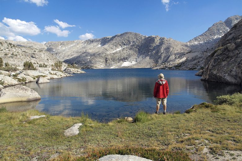
A hiker contemplates the sparkling waters of an alpine lake deep in the Sierra backcountry.
Backpackers and hikers stop off at the Mineral King Ranger Station to pick up trail maps, permits and bear canisters, while car-bound adventurers consider area campgrounds or the Silver City Mountain Resort, which offers cabins, a humble market and a restaurant.
Tip: If you’re camping or backpacking in Mineral King, keep an eye out for resident marmots, which are notoriously thievish when it comes to your favorite trail snacks.
The Giant Forest & Lodgepole
The Giant Forest is where Sequoia’s biggest namesake trees hold court. The Congress Trail beckons visitors through groves of titanic trees, including what’s considered the biggest tree in the world, General Sherman, standing 275 feet tall with a trunk that’s as wide as a three story house is tall (36 feet!).
Climb beyond the canopy on the Moro Rock Trail, where a collection of stone and concrete steps lead hikers to Moro Rock’s granite dome—the top of which features a flat summit offering views in all directions. Backpackers setting off on the inimitable High Sierra Trail will want to stop in at the Lodgepole Visitor Center for permits and trail info. The adjacent Lodgepole Village also acts as a great base for families and car campers. Two seasonal campgrounds offer ideal spots to pitch a tent, and the Wuksachi Lodge provides a cozy place to stay during snowy winter months.
Crystal Cave
Sequoia is as unique for its incredible cave systems as it is for its giant trees. Visitors who want to explore the park’s subterranean side can do so on a ranger-led tour of Crystal Cave. On a half-mile loop, you’ll learn about the cave’s delicate stalactite and stalagmite formations and find out what sort of creatures make this deep, dark den their home.
Two things to keep in mind when visiting Crystal Cave: 1) The cave is only accessible via guided tours that quickly sell out, so you must buy your tickets in advance before you arrive at the cave; and 2) temperatures inside the cave hover around 50 degrees, so remember to pack a jacket.
Kings Canyon National Park
Kings Canyon National Park runs along the northern boundary of Sequoia National Park. Because of their proximity and shared infrastructure, the National Park Service operates the parks together as the Sequoia and Kings Canyon National Parks. Most activities in Kings Canyon National Park start in either Cedar Grove or Grant Grove. Cedar Grove is the perfect place to start explorations of Kings’ rushing river canyons, lofty granite domes, and lowland meadows. The Zumwalt Meadow trail offers hikers a sample platter of Kings’ most iconic scenery, while the Don Cecil route is ideal for those who want a bird’s-eye view of the park. As a bonus, the Don Cecil trail climbs the north side of Kings Canyon which makes it a cooler alternative on hot summer days.
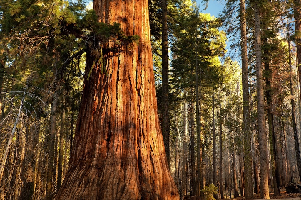
Sequoia National Park and neighboring Kings Canyon National Park are home to some of the largest trees on Earth.
Not to be outdone by its southern neighbor, Kings is also home to one of the most impressive collections of sequoias in the world. In Grant Grove, loop around the General Grant Tree trail to find yourself dwarfed by the second-largest tree on Earth, or check out the North Grove Loop for an equally neck-craning experience without the crowds.
The Top Outdoor Activities in Sequoia National Park
Sequoia’s nearly endless backcountry options and dynamic elevation (which ranges from 1,370 feet to 14,494 feet) make it a playground for a huge array of activities. Hikers can find lowland trails and alpine scrambles, backpackers can explore the park’s full range on a single trail, and rock climbers will find plenty of routes to the top on sheer granite walls. In the winter, snowshoers and backcountry skiers glide between the trunks of sequoias to find cozy winter lodges, and car campers can experience the park in all seasons with a variety of campgrounds.
1. Hiking
With access to a variety of elevations along the Generals Highway—the park’s central, scenic roadway—day hikers can dip in and out of Sequoia’s diverse terrain with ease. From roaming the oak-studded valleys of the Foothills to topping Moro Rock’s granite dome in the Giant Forest, you could spend a lifetime exploring all that Sequoia has to offer. But here are a few trails to get you started:
Following the Marble Fork of the Kaweah River, the Tokopah Falls Trail is a perfect out-and-back trek for those visiting the Lodgepole area. Wind through granite canyons and conifer forests to reach the 1,200-foot falls which reach their peak of majesty in early summer, when snowmelt is highest.
The Timber Gap Trail starts in Mineral King, the heart of Sequoia National Park. Think of Timber Gap as a base trail. On its own a wonderful day hike with mountain meadows, red fir forests and sweeping views of Mineral King Valley, Timber Gap is also the starting point for those who want to reach Monarch Lakes and Crystal Lakes, or go all out on the Mineral King Loop.
For a less-crowded look at the sequoias around the Giant Forest, head out on the Congress Trail and then split onto the Trail of the Sequoias near the General Sherman Tree. This 2.8-mile route snakes through groves of sequoia trees before terminating at Tharp’s Log, a fallen sequoia hollowed out into a cabin by a 19th-century rancher.
2. Backpacking
Sequoia offers backpackers the chance to explore the classic granite and alpine terrain of the Sierra Nevada mountains and the Great Western Divide. Keep in mind, wilderness permits are required for camping, so make sure to check in at the ranger stations or visitor centers before heading out on the trail. The High Sierra Trail is the holy grail of Sequoia’s routes, but backpackers who venture in other directions will find plenty of other loops and treks that are equally mesmerizing.
Sleep beside alpine lakes, watch the moon rise over glittering tarns, and meander through lowland valleys filled with blue oak and massive sequoias on the High Sierra Trail, a 66.5-mile trek showing off the best of the Sierras and Great Western Divide. As a grand finale, the eastern edge of the route intersects the John Muir Trail which climbs to the summit of Mount Whitney before leading backpackers back to civilization along a variety of possible routes. Keep in mind, the High Sierra Trail is a one-way trek, so you’ll want to consider whether you want to retrace your steps, or arrange transportation back to the trailhead at Crescent Meadow in Giant Forest.
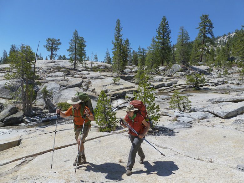
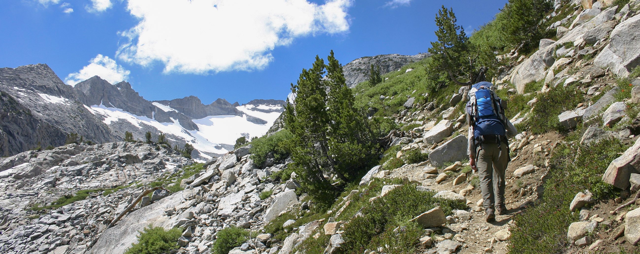
Exploring the park on foot yields spectacular payoffs around every corner and tree trunk.
The 25.6-mile Mineral King Loop is an off-the-beaten-path favorite of backpackers looking to explore the full range of Sequoia National Park. Navigate over Blackrock and Sawtooth passes, sleep next to the crystal waters of Columbine Lake and find peace and quiet among the conifers, creeks and meadows of Lost Canyon.
Rae Lakes Loop (Kings Canyon National Park)
Although not technically in Sequoia National Park, the Rae Lakes Loop is close by and is a can’t-miss destination for backpackers who want to experience unforgettable environments. Beginning on the floor of Kings Canyon, the trail winds up into a maze of granite domes and boulder-strewn passes that ultimately lead to a treasure trove of cobalt-blue alpine lakes.
3. Skiing & Snowshoeing
Snow blankets much of Sequoia National Park throughout the winter, when crowds are at a minimum. But that doesn’t mean there’s nothing to do. Snowshoeing and skiing are possible on many of the park’s most notable trails. Rent equipment from the Wuksachi Lodge’s Alta Ski Shop and venture out on your own, or opt for a guided ranger-led snowshoe trek, which leaves from Giant Forest throughout the winter. While winter camping is always an option, those wanting more creature comforts can stay at the Wuksachi Lodge. Or, embrace the season by reserving a night at the Pear Lake Winter Hut, accessible via a 6-mile trail from Wolverton Meadow.
4. Rock Climbing
With similar geography to its more northerly neighbor, Yosemite, Sequoia National Park offers rock climbers a bounty of trad, alpine and bouldering opportunities. And, in winter, accessible walls give ice climbers a chance to hone their skills. For easily accessible trad routes, head to Moro Rock’s granite dome. The Tokopah Valley is an ideal playground for shoulder-season ice climbing, as well as alpine routes. And, while boulders are strewn throughout Sequoia National Park, aficionados of the sport will want to hop into Kings Canyon to experience the boulder fields around Cedar Grove.
5. Camping
There are seven established campgrounds in Sequoia National Park. Sites allow a maximum of six people and are available on a first-come, first-served basis, with the exception of Potwisha and Buckeye Flats campgrounds in the Foothills area, which can be reserved online up to six months in advance. Expect to find decent amenities at campgrounds including picnic tables, fire rings with grills, and metal boxes to store your food in, away of the prying paws of bears, raccoons, marmots and other critters.
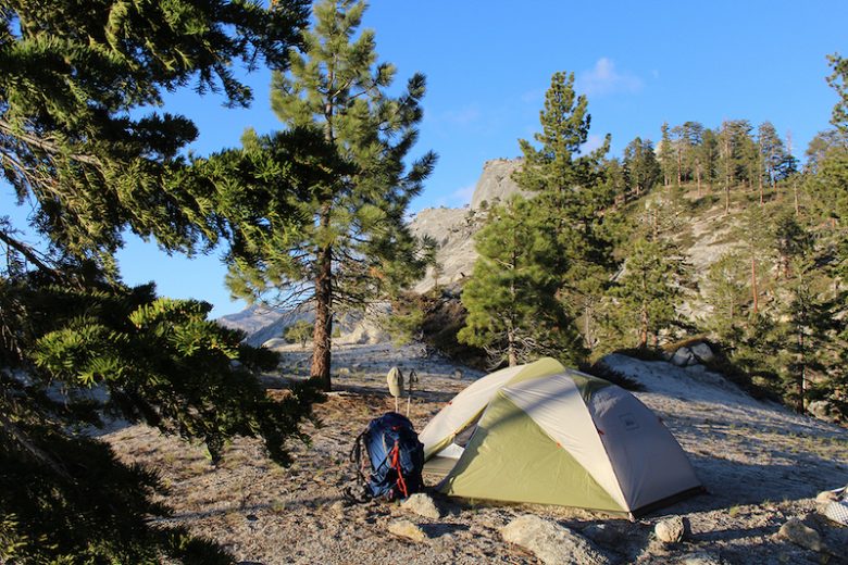
Need some rest after along day on the trail? Grab a backcountry permit and camp in the alpine.
Keep in mind, the only campgrounds open year-round are Potwisha and South Fork. Others typically open in late spring and close when weather demands, usually in late fall. Also, consider that the vast majority of Sequoia National Park is designated wilderness and wilderness permits allow you to camp throughout the backcountry. If it’s your first time backpacking, make sure to plan accordingly and always follow Leave No Trace principles out on the trail.
How to Plan Your Trip
How you plan your trip will largely depend on the type of activity you’re planning to do. Backpackers should arrange their wilderness permits well in advance of summer trips, as a limited number of people are allowed on the trail during the high season (typically from late May through late September). Permit reservations begin in March. For day hikers, no permit is required.
Most campgrounds are available on a first-come, first-served basis, with the exception of a few that can be reserved online. And, if you’re planning on driving, make sure you check road conditions and park rules, which limit the size of vehicles on certain narrow, winding roads.
Best Time to Visit
Choosing the best time to visit comes down to your preferred activities. Summer is easily the high season in Sequoia National Park, when receding snow lines open up the entirety of the park’s areas for visitors to enjoy. Early fall and late spring are the best time to beat the crowds, though finicky weather may present some day-of surprises with rainfall or even snow in the forecast. Shoulder seasons also present the park in unique, but fleeting moments. Namely, the changing foliage of oaks and cottonwoods in the Foothills and meadows erupting in wildflowers in late spring.
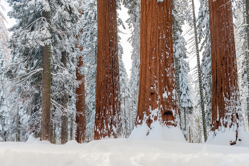
Giant sequoia trees wait out the winter’s chill in Sequoia National Park.
Winter transforms the park. All but the lowest areas see months of consistent snow, which dusts the tops of sequoias and contrasts with their orange-brown bark to create an ethereal landscape. And, because cross-country skiing and snowshoeing opportunities are plentiful, there’s no reason a winter visit has to restrict your ability to get outdoors and enjoy the park.
Getting Around
Roads in and around Sequoia National Park are steep, winding and narrow. Some entrances are only open seasonally, and others have restrictions on vehicle length which make them unusable for those with vehicles over 22 feet long, like RVs and trailers. Check road conditions before you head out and consider calling the ranger station to make sure your route is open and well-suited for your vehicle type.
The Generals Highway is the park’s central road. With regular overlook pullouts, it offers an incredible introduction to the park as it winds from the Ash Mountain entrance north to Kings Canyon National Park.
For drivers who want to maximize time on the trail and minimize time spent looking for parking, consider using the park’s free shuttle system. Regular routes connect the park’s main areas. And for $20, guests can also catch a round-trip ride from the neighboring towns of Visalia and Three Rivers.
What to Pack?
A wide range of elevations means that temperatures and weather vary significantly throughout the park. Between Foothills (approximately 4,000 feet) and Lodgepole (7,000 feet) temps can fluctuate as much as 30 degrees. In the backcountry, elevations soar to 14,000 feet at Mt. Whitney.
Pack layers appropriate to your intended activity. In the fall and spring, waterproof boots, hiking shirt and rain gear will help you handle hikes through potentially cold, rainy or even snowy conditions. If you’re backpacking, proper food storage is required in some areas of the park (you can be fined), so make sure you have a food canister to help prevent the park’s black bears from getting at your food. If you don’t have one, bear canisters may be rented from the park’s ranger stations.
