There’s no better stretch of blacktop for a West Coast road trip than California’s State Route 1, better known simply as Highway 1. For over 650 miles, from Orange Country in the south to Leggett’s redwood groves in the north, it winds past dramatic coastal cliffs and ethereal waterfalls, over the Golden Gate Bridge and through charming beach towns like Santa Barbara, Ventura and Monterey. But if there’s a first among equals on Highway 1, it’s Big Sur. The 90-mile stretch of mountainous coast, which starts around San Simeon and ends near Carmel Highlands just south of Monterey, is packed with plenty of adventures worthy of a pit stop.
Start inland at San Luis Obispo, one of the oldest European settlements in the state, where Highway 1 separates from Highway 101 and makes a break back for the coast. Because while it’s just 135 miles from here to Monterey—a three-hour drive if judged by a map—it’s a region that could take days to fully explore. To save you some time on your journey, we’ve rounded up a few of our favorite hikes, rides, swims, surfs, climbs and camps along the way.
Stop 1: Bishop Peak
At 1,546 feet in elevation, Bishop Peak is the tallest of nine volcanic plugs (known as the “nine sisters” or “the Morros”) that link San Luis Obispo to Morro Bay. It’s also just a 10-minute drive from San Luis Obispo. Though it’s home to great hiking—including the 1.7-mile Bishop Peak Trail, which summits the mountain—we recommend pulling out a harness and climbing shoes instead of boots and trekking poles. The dacite volcanic rock has climbs for all skill levels. Beginners should check out the sport, trad and top-rope routes at Garden Wall, which range from 5.6 to 5.9. Those more experience should make the trek out to Cracked or P-Wall, two crags where ratings start at 5.6 and top out 5.12a.
Stop 2: Montaña de Oro State Park
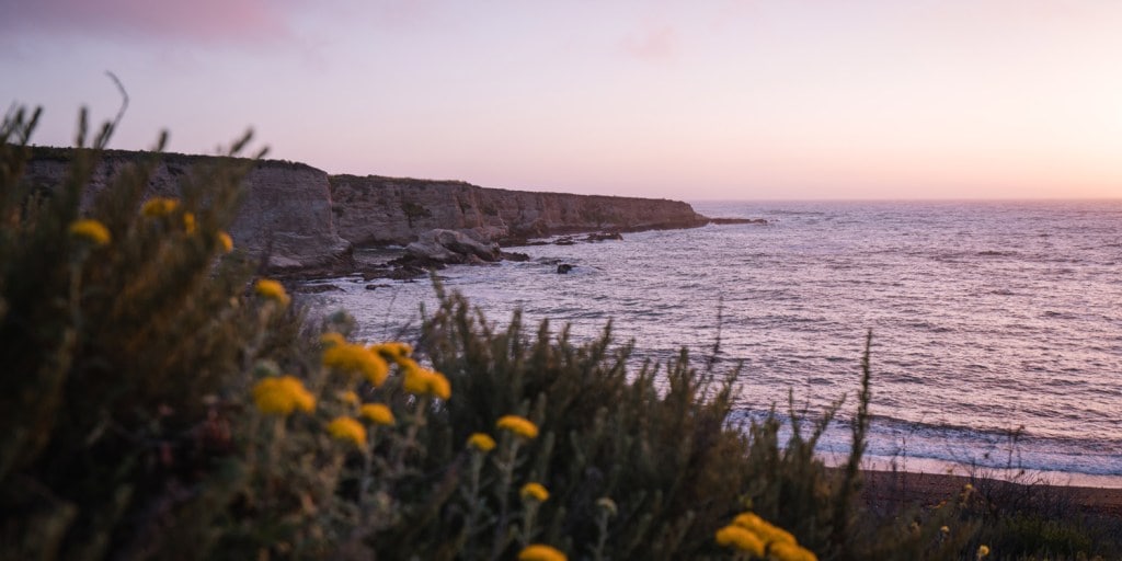
The wildflowers of Montaña de Oro State Park. (Photo Credit: Jose Magana on Unsplash)
There are plenty of reasons this coastal state park is worth a stop. Swim or relax on the sand at Spooner’s Cove; hike along its valleys, sea cliffs and mountain ridges; or if it’s spring, drink in the yellow wildflowers that give the park its name, which translates to mountain of gold. But our favorite reason for a visit is getting in the saddle and hitting the trails. The park is home to a network of mountain biking routes that suit all abilities. The intermediate Oaks Peak Trail, a 11.3-mile out-and-back with 1,400 feet of gain and flowing dirt and rock singletrack with stunning ocean views, is a good bet for a longer ride. But if you’re looking for a quick trip, the 2.3-mile point-to-point multiuse Bluff Trail offers cliff-top views that are just as stunning.
Stop 3: Morro Bay
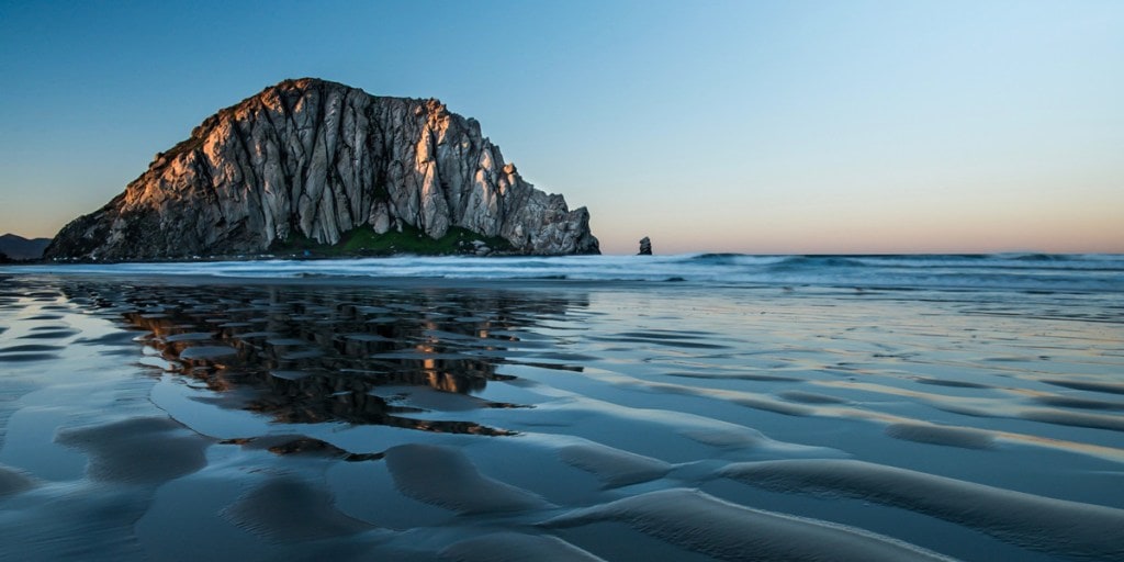
Morning at Morro Rock. (Photo Credit: Luke Dahlgren on Unsplash)
For the best views of Morro Bay and the iconic Morro Rock, the last of the Nine Sisters, look no further than the popular Black Hill Trail in Morro Bay State Park. The easy-to-moderate 2.5-mile roundtrip gains about 600 feet of elevation as it snakes through eucalyptus groves, coastal shrubs and oak trees, though the highlight is its 360-degree-view of the estuary, town and inland peaks. If you packed a surfboard, the consistent (and occasionally powerful) swells at Morro Bay and Morro Beach mean their beach breaks are great for beginners and intermediates. If you’re a pro, the reef break at nearby Mouse Rock is what dreams are made of when the swell is big.
Stop 4: Silver Peak Wilderness Area
Up the coast from Morro Bay, you’ll head into Big Sur proper, which officially starts near the town of San Simeon. Though this stretch of coast is famed for its rugged nature, being famous also means it’s popular. Escape the crowds by heading into this 31,555-acre wilderness area inside Los Padres National Forest. The 5.5-mile point-to-point Salmon Creek Trail follows its oak-shaded namesake stream into the scrubland higher up the mountains. You’ll barely leave the trailhead before you reach a short spur trail that leads to Salmon Creek Falls. A left turn takes you to the 100-foot-plus falls, a right takes you deeper into the wilderness, perfect for a backcountry overnight.
Stop 5: Kirk Creek Campground
Pitch a tent at Kirk Creek Campground, about an hour and a half north of Morro Bay, and you’ll enjoy falling asleep to the sound of the surf. Its 40 tent and RV campsites sit on a grassy bluff overlooking the Pacific and the chiseled Big Sur coastline, and it’s only a short walk from your tent down to the small, rocky beach. Make sure to keep an eye on the ocean for the occasional breaching whale.
Stop 6: Limekiln State Park
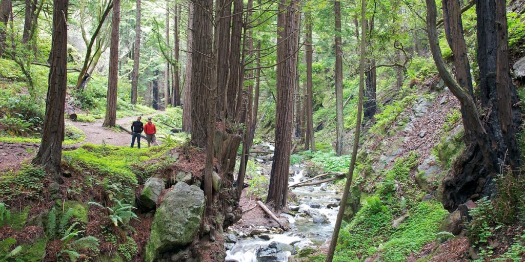
A trail runs alongside a creek in Limekiln State Park. (Photo Credit: Kevin Stanchfield under CC BY 2.0)
It’s hard to believe that this remote locale of Big Sur actually played a role in the construction of San Francisco and Monterey, but the area’s kilns once purified the region’s precious limestone to help make much-needed concrete. While the operation closed in the late 1800s, remnants of four kilns still stand in this wildly scenic park comprised of looming coastal redwoods, a rocky beach between rugged bluffs, a flowing creek and 100-foot-tall Limekiln Falls. There are 24 campsites, and short trails that lead you into the forest. Or use it as a basecamp to go deeper: The park abuts the Limekiln State Wilderness, Ventana Wilderness and Los Padres National Forest.
Stop 7: Julia Pfeiffer Burns State Park
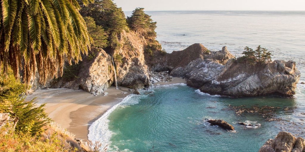
Big Sur’s iconic McWay Falls. (Photo Credit: Jul1an_DE)
Home to 80-foot McWay Falls, one of the most surreal and beautiful cascades on the California coast, this state park is not to be missed. Sometimes at high tide the waterfall tumbles straight into the crashing Pacific. But you should head inland, too. The 4.8-mile Ewoldsen Loop follows McWay Creek through the redwoods to the shrub-covered hills above. With over 1,430 feet of elevation gain and an 11 percent average grade, don’t expect an easy stroll, but the short detour along the Overlook Trail will take you to views worthy of the effort.
Stop 8: Pfeiffer Big Sur State Park
You’ll find nearby Pfeiffer Big Sur State Park inland among the redwoods. Trails meander up into the desolate Santa Lucia Range and offer up a wide variety of difficulties. One of the big draws is Big Sur River Gorge, where a narrow path leads up the river and there are plenty of swimming holes to keep you cool on hot days. Make sure to check out nearby Big Sur Bakery, which serves up mighty fine baked goods whether you’re looking for breakfast or a trail snack. Four miles south of the park is Nepenthe, a terraced restaurant perched high above the ocean. Grab a cocktail to enjoy with the sunset or stay for dinner. The views are as good as its signature Ambrosia burger and King Salmon. Plus, Pfeiffer Big Sur State Park is the largest campground in the area, meaning it’s a short drive home for the night if you want.
Stop 9: Andrew Molera State Park
(Editor’s note: Some trails in the park are closed. Check here for updates.)
This 4,766-acre park offers a little bit of everything from birdwatching to mountain biking, swimming and surfing. If you have some time, there are plenty of hikes to get out and explore the redwoods, the tranquil Big Sur River and the secluded coastal bluffs and beaches. (Our pick? The 7-mile Molera Beach Super Loop.) But if you only have time for a short stop, drop by the park’s Molera Ranch House Museum where the ranch foreman’s former home now displays artifacts from Big Sur artists, authors, settlers and Indigenous peoples.
Stop 10: Bixby Bridge
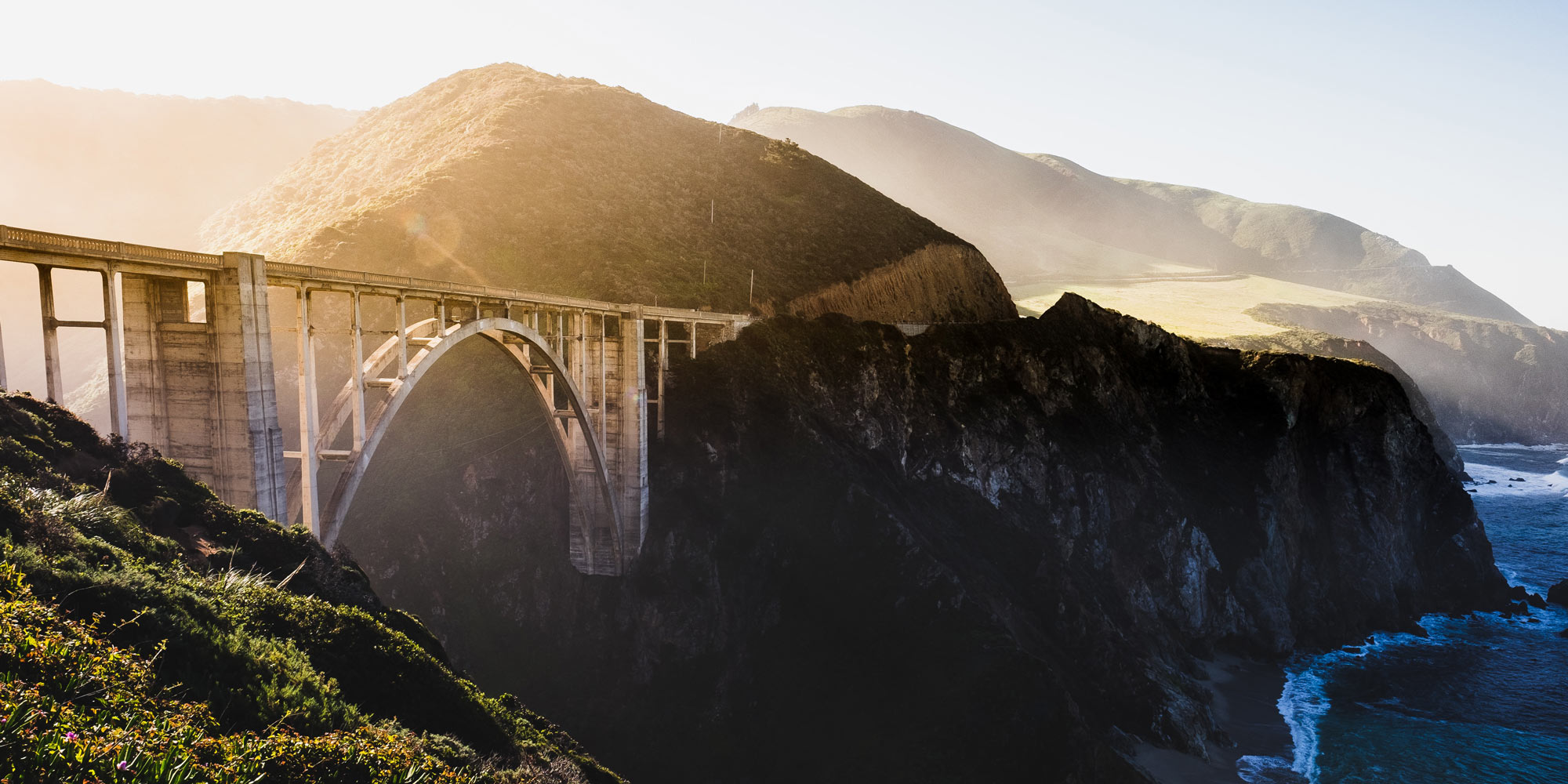
The Bixby Bridge is quite possibly one of the most photographed landmarks in California and Big Sur. And for good reason. Built in 1932, the art deco bridge’s 342-foot-long center arch links two steep, verdant canyon walls that tumble to the ocean nearly 300 feet below. If you’re headed south, one of the best vistas is from the Castle Rock Viewpoint right before the bridge. It’s also almost always packed. For a different angle, head a little ways up the Old Coast Road. Just make sure your vehicle has high clearance and good traction.
The Whole Shebang: San Jose to Santa Barbara by bike
To see the coast in a different light, hop on a road bike. Highway 1 is one of California’s premier cycling routes, and a tour of Big Sur from Monterey to San Simeon only takes two or three days. Or if you have the legs, you can cycle the whole Central Coast in about a week. Plan your trip yourself, or let someone else take care of the logistics for you.
