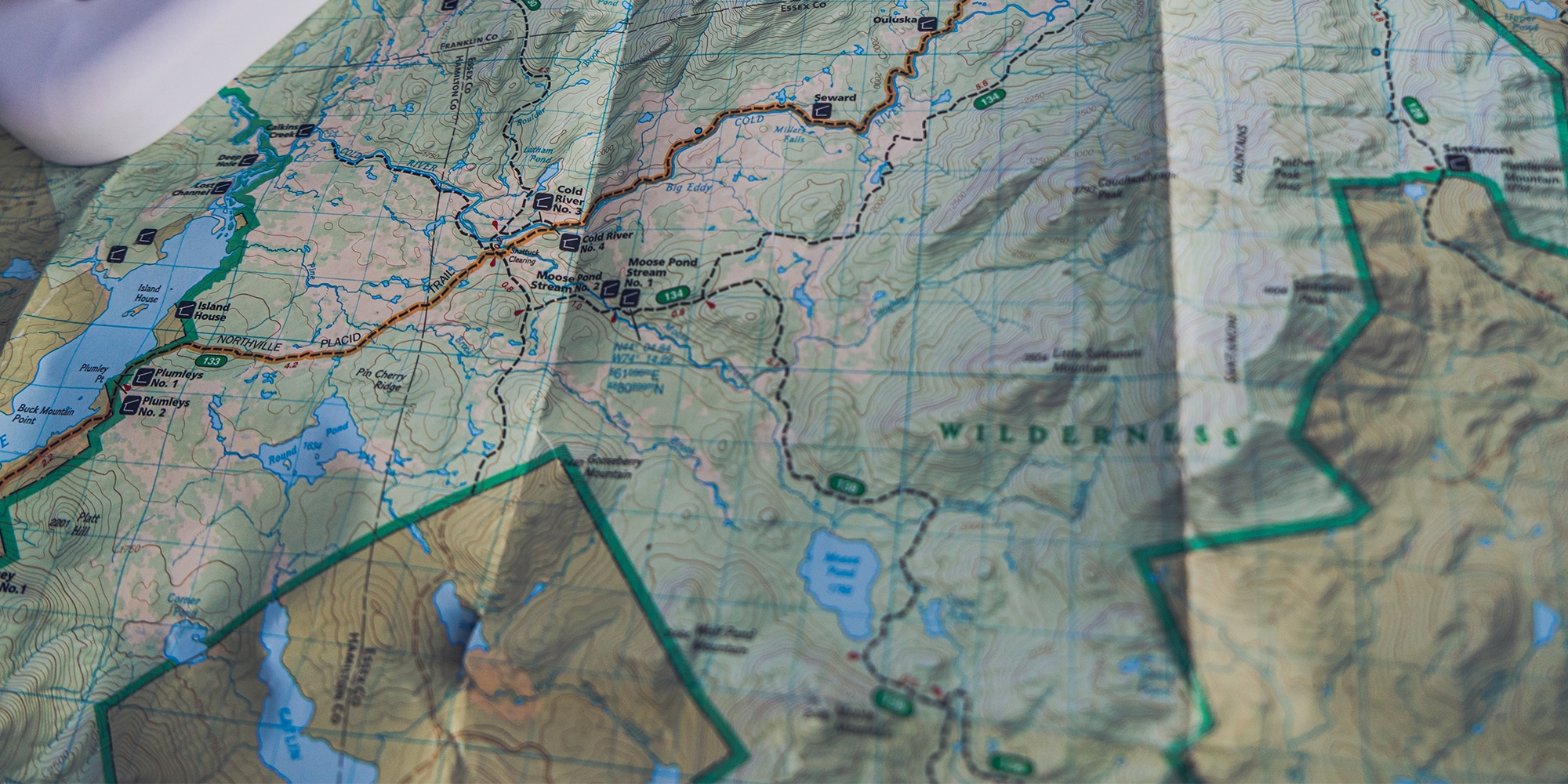
From where I sit, I can see the blue-blazed Northville-Placid Trail snaking through the rough-and-tumble High Peaks Wilderness Area in New York’s Adirondack Mountains. It jumps sky-blue streams and emerald-green meadows, passing three-sided lean-to shelters named for the water they overlook.
I can pick out Big Eddy, a giant whirlpool along the Cold River, and the slow tumble of Millers Falls just upstream. In the other direction, appropriately named Long Lake stretches to the edge of my horizon, dotted with tiny islands and bays begging for a separate canoe trip. At its middle—right about where the Kelley Point and Rodney Point Lean-tos await weary hikers and paddlers—a shiny piece of packaging tape holds together a seam that has been folded and unfolded too many times.
North of that, near where Raquette Falls should be, there’s a blue smudge where a drop of bug spray with more DEET than I ever care to use again has smeared once-clean lines. I remember camping not far from that spot once and looking at this map while black flies dined on my bare arms without reservation and, in the moment, choosing—also without hesitancy—a solution toxic enough to wipe the print clean off the waterproof paper.
From the distance of my home in Boulder, Colorado, roughly 1,600 miles west, I read this map like I do a book. Spreading a random selection out on the dining-room table in front of me, it’s easy to spend hours scanning every dotted line and ribbon of blue. I look at the contour lines—light-brown squiggles over a green background—and the peaks and valleys spring up like I’m actually there. When I look at a map like this one, National Geographic’s Trails Illustrated map number 742, I remember the trips I took there years ago.

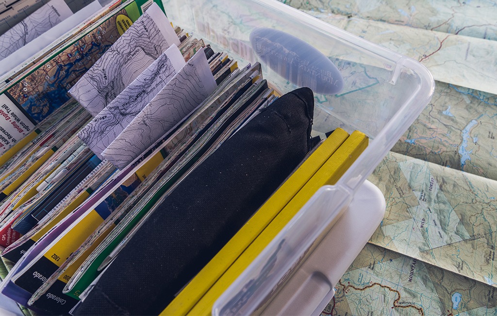
The author’s box of maps
This 2-by-3-foot topo has seen more than many of the maps in my collection. Enshrined in its folds, tears and wrinkled edges is my youth, when this exact copy spent countless weekends flapping out of the water-bottle pocket in my pack while I bushwhacked my way up Adirondack 46ers and paddled the Saranac Chain, discovering the outdoors and my newfound independence.
But this is only one of the dozens of options I have cataloged in the plastic bin where I store my collection of maps. It’s filled with the tokens of past trips, scored from years of traveling, hiking, camping, paddling and climbing around the world. I have topos of the Alaska Range still smudged with glacial dust and annotated in pencil. There are maps of Maine’s Katahdin Woods and Waters National Monument that I printed myself on waterproof paper with my exact routes and waypoints charted. There are free national park maps of Joshua Tree, Acadia and Arches picked up from the entrance kiosks. You never know when you might need beta on a tour road.
Without fail, there’s a map in that box to represent nearly every place I’ve ever been with hiking boots on, which puts surfing its pages on par with looking at old photos and journal entries. But reminiscing is only part of the equation.
With COVID-19 sidelining me from the epic adventures that used to define my summers, the most I can do is daydream about trips I hope to take one day. And for that, a paper map is the best vehicle to the trailheads I conjure in my head from my quiet dining room.
Also inside my box of maps are topos detailing the places I’ve yet to go. There’s one that shows the otherworldly landscape of Canyonlands’ Maze District and another that displays a wide-angle overview of Nevada’s Ruby Mountains, which I picked up after a friend recommended the area. There are custom printouts of Canada’s Mount Robson with climbing routes sketched on top and a map of Montana’s Beartooths that I snagged in preparation for a trip next year. There are maps of trips that never panned out and of every place that’s caught my eye in the past 10 years. And lately I’ve found myself thumbing through the stacks more often than ever before.
With COVID-19 sidelining me from the epic adventures that used to define my summers, the most I can do is daydream about trips I hope to take one day. And for that, a paper map is the best vehicle to the trailheads I conjure in my head from my quiet dining room. I leaf through my bin and select a map almost arbitrarily, unfurling it across my table. I pick out a cool-looking valley or imagine what the vista from atop a ridgeline might look like. I go there, if only in my own mind, and visualize the scale of the area, contemplating how its trails spread across the wilderness and intersect, how its valleys and ridges align. I can picture a bird’s-eye view not even a drone could produce.
None of us are traveling too far from home right now, but even without a global pandemic, I don’t get back to the Adirondacks as much as I would like to. The lines on this map, number 742, get me close. I can run my eyes over the orange-highlighted line of the Northville-Placid Trail from Tirrell Pond (where I recall a time when a friend and I were visited by an eerily comfortable buck one night around a campfire) to Wanika Falls (where we took an abandoned route, sketched in pencil, toward Oseetah Lake). We did this whole section in five days, and I can identify every lean-to we stayed in.
As I’m hiking it all over in my mind, a trail leading northwest from Shattuck Clearing catches my eye—I don’t remember seeing it before. It follows the Cold River downstream toward the top of Long Lake before dead-ending. I bet it has good fishing—that might make for a fun trip. I wonder if there are dry places to tent. I think I have another map in this box that will tell me about campsites, hold on.
For more odes about our favorite stuff, check our Gear I Hold Dear series.
