Whether hiking in the shadow of Devils Tower or following a stretch of one of the world’s longest footpaths, the best way to celebrate is by recreating on public lands.
It’s been a tough couple of years for America’s public lands. In 2016, a band of armed militants took over a wildlife refuge in southeastern Oregon to protest the federal government’s right to manage land. This summer, Interior Secretary Ryan Zinke recommended shrinking a handful of national monuments. And all that’s to say nothing of the wildfires currently decimating large swaths of forestland throughout the West.
But National Public Lands Day on Saturday, September 30, is a time to remember why these wild places matter to public land owners—which is to say, all U.S. citizens. Here are five hikes to help you celebrate.
Wyoming: Grand Prismatic Spring
4 miles through the country’s first-ever national park
Located in Wyoming, Montana and Idaho, Yellowstone National Park’s famous geysers inspired the U.S. Congress to declare it the country’s first national park on March 1, 1872. Since then, millions of visitors from around the globe have stood next to Yellowstone’s soaring geysers and colorful hot springs, snapped photos of the park’s grizzly bear and bison populations, and camped under its wide-open, starry night sky.

Grand Prismatic | Photo: Tupulak, Flickr
You could spend weeks in Yellowstone without seeing everything, but a hike to Grand Prismatic Spring should sit atop every visitor’s bucket list. With a diameter of 371 feet, the hot spring pool at Grand Prismatic is Yellowstone’s largest (and among the largest in the world). It hosts a kaleidoscope of color that begs to be photographed; the rich sapphire and emerald hues at its core come from dissolved minerals, while sulphur deposits and extremophiles give its edges a green, yellow and fiery orange halo.
While you can reach the spring pool via a half-mile boardwalk on the geyser’s north side, get a broader, more sweeping view by adding a few miles: Start at the nearby Fairy Falls Trailhead and pass countless lodgepole pines and 197-foot-tall Fairy Falls as you cover the 4-mile trail before arriving at Grand Prismatic Spring.
West Virginia: Loudoun Heights
A glimpse of history on one of the world’s longest trails
The Appalachian Trail is a testament to determination, tenacity and America’s love for wild spaces. One of the world’s longest footpaths, the AT covers roughly 2,200 miles and spans 14 states along the Appalachian mountain range. If you’re not up for a months-long odyssey, we’d recommend a day hike on the AT to appreciate the magnitude of the trek and the natural beauty along the way through Virginia’s Harpers Ferry National Historical Park.
Sitting at the confluence of the Potomac and Shenandoah Rivers, Harpers Ferry is best known as the site of abolitionist John Brown’s effort to spur an uprising in 1859. Today, the historic park is home to the Appalachian Trail Conservancy’s headquarters, in addition to more than 20 miles of hiking trails.
The 6.2-mile Loudoun Heights hike offers a secluded glimpse of the important region. You’ll follow the AT’s iconic white blazes before veering off onto other interconnected trails that showcase the area’s Virginian hardwood forests, unimpeded mountain views, colorful fall foliage and panoramic vistas of Harpers Ferry.
Utah: Willis Creek
Hike through a slot canyon in the first ever BLM monument
More than 20 years ago, President Clinton established the Grand Staircase-Escalante National Monument in southern Utah, the first such monument designated for management under the Bureau of Land Management (BLM). Today, the largest national monument in the United States welcomes visitors from around the world to explore its 1.9-million acres of rugged rock.

Willis Creek slot canyon | Photo: Anna Irene, Flickr
One step into the unusually accessible, six-foot-wide canyon along Willis Creek, and you’ll see why leaders worked so hard to protect this fascinating piece of land. Towering walls hide the sun, and the perfectly-curved rocks appear almost painted-on.
Officially, Willis Creek is a 3.4-mile out-and-back, with roughly 200 feet of elevation change. (You’re descending into the canyon, so save some energy for the ascent on your way out.) That said, you can enjoy as much or as little of the canyon as you’d like; a short waterfall greets you on the way in, and the rest of the trail follows the Willis Creek bed the whole way.
Friendly reminder: Check with a ranger at the visitor center in nearby Cannonville to inquire about flash flood possibilities before descending into Willis Creek.
Wyoming: Red Beds and Tower Trails
An iconic rock formation in America’s first national monument
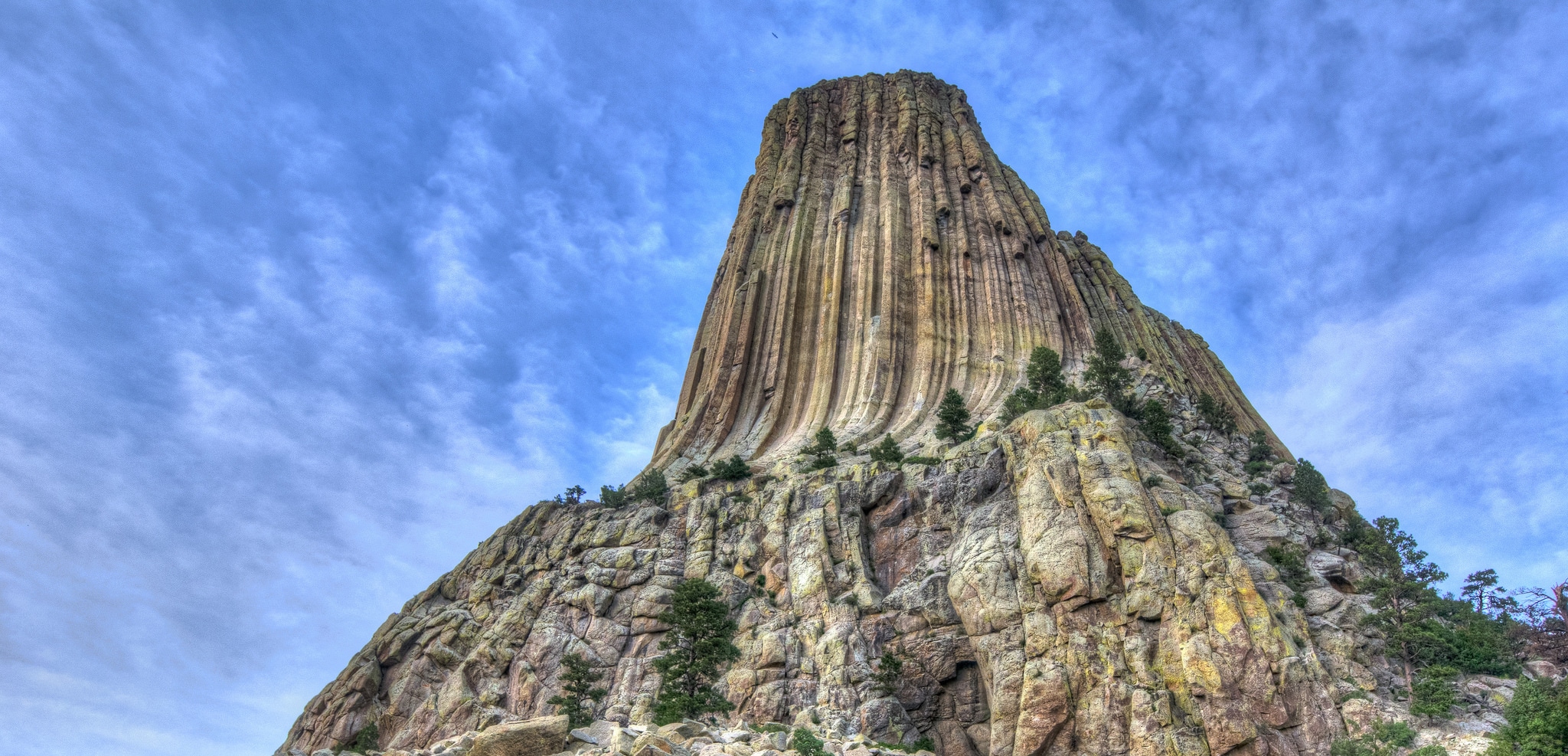
Even if you don’t know it by name, you might recognize Devils Tower National Monument from Steven Spielberg’s Close Encounters of the Third Kind. The monolithic rock formation, covered in hundreds of parallel cracks, rises from the prairies of northeastern Wyoming and is among the country’s most recognizable landmarks.
Devils Tower isn’t just famous for its cameo in big-budget sci-fi movies, though. President Roosevelt established the imposing rock as the United States’ first national monument on September 24, 1906. Today, it’s most popular with rock climbers, but Devils Tower also hosts a few hikes that showcase its grandeur and natural beauty.
Friendly reminder: Devils Tower is a sacred site for local Native Americans (in fact, some advocate for the name to be changed), so take care not to disturb any artifacts you may find.
Red Beds Trail
The Red Beds Trail certainly offers up-close views of Devils Tower, but it introduces hikers to the region’s fascinating geography and ecology, as well. The 3-mile hike delivers views of the Black Hills, the Belle Fourche River (and its floodplain), Ponderosa pine forests and the stark, cinnamon-hued red badlands.
Bonus Hike: Tower Trail
Want a closer look at the Tower? Head to the 1.3-mile Tower Trail. The mostly-flat, mostly-paved loop circles the entire rock formation, offering unbeatable views nearly every step of the way. You’ll pass massive boulder fields and through some Ponderosa pine forestland, but the tower is the star of this jaunt.
North Carolina: Baxter Creek Trail
Sweeping vistas of the country’s most popular national park
Great Smoky Mountains National Park, straddling the North Carolina-Tennessee border, received 10.7 million visitors in 2015—almost double that of the second-most popular national park. (Grand Canyon National Park saw 5.5 million visitors.)

Baxter Creek Trail | Photo: Miguel Vieira, Flickr
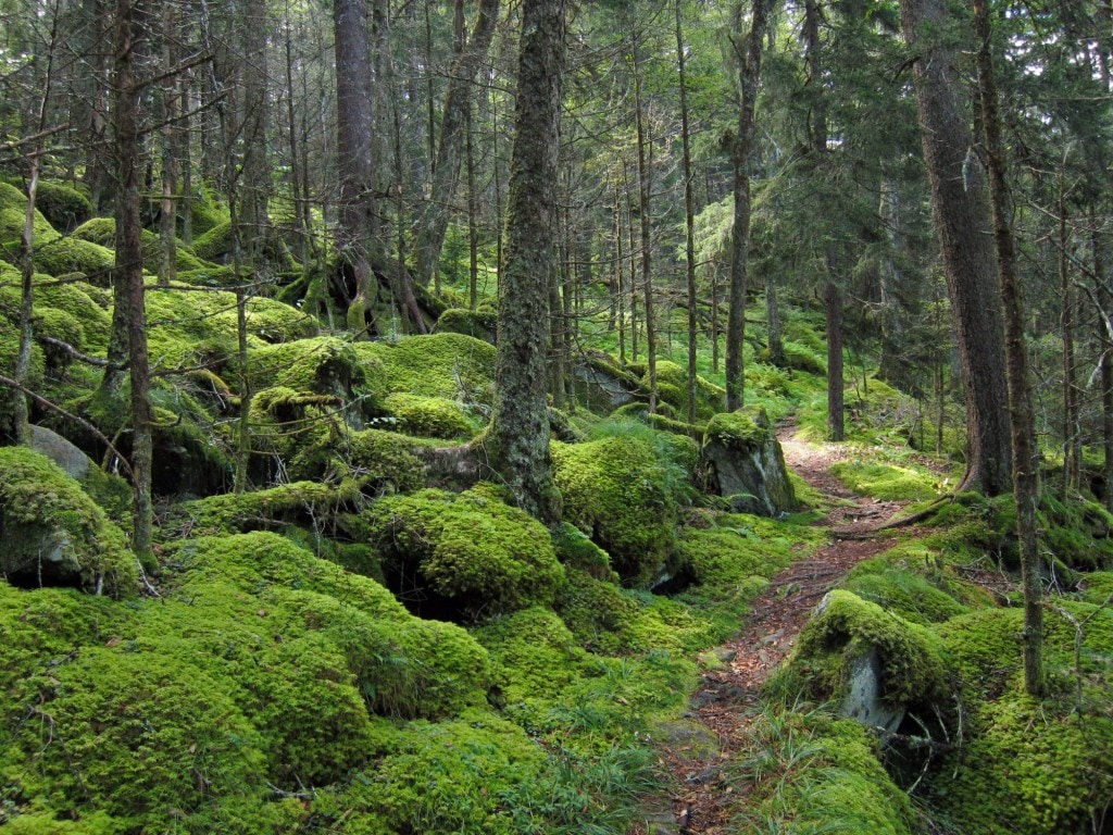
Great Smoky Mountains National Park doesn’t need our help attracting visitors, but we’d be remiss for not pointing you toward the 6.6-mile Baxter Creek Trail, which offers a surprising mix of springtime wildflowers, vivid fall colors, rich wildlife and one of the most sweeping views within the park. Gaining more than 4,000 feet, the trail makes you work for that natural wonder. You’ll start climbing right away, passing through a thick, wooded area before reaching the Mount Sterling Ridge.
After six difficult miles, arrive at a historic fire tower built in 1935 by the Civilian Conservation Corps. At this viewpoint, you’re 5,842 feet above sea level; climb another 60 feet to the top of the fire tower for unimpeded panoramic views of the Smoky Mountains.


