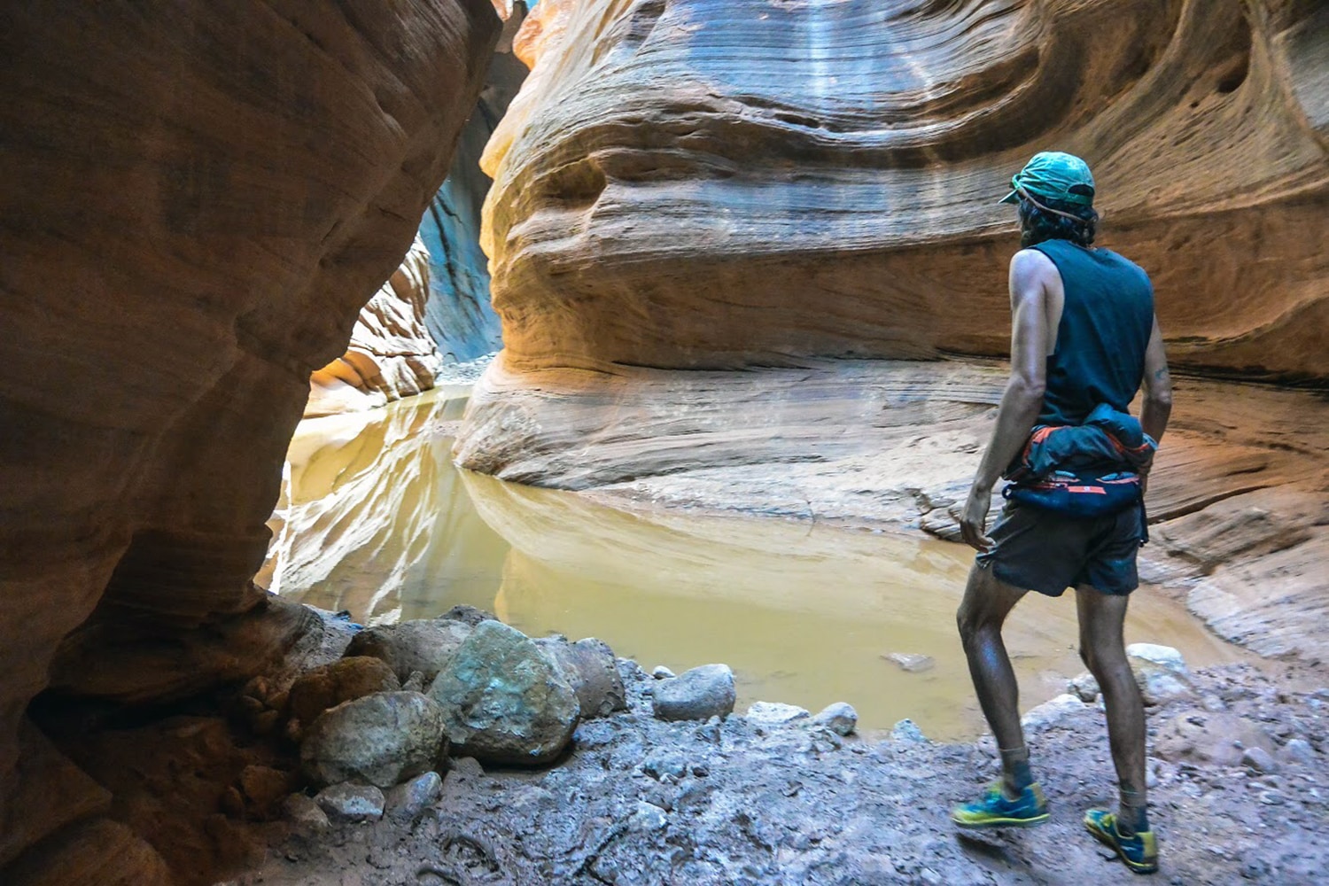
My first slot canyon running experience was life changing—the intricate twists and turns of Utah’s Buckskin Gulch, one of the longest slot canyons in the world, left me smiling for miles. I fell in love with running in the mysterious places beneath the obvious line of sight. I even went on to write a book about trails in the Southwest after that.
Unlike running up a mountain, in which the objective is visually obvious, canyon running kept me on my toes with plenty of surprises, like waist-deep pools of cold water, technical down-climbs from 10-foot-high boulders and ancient petroglyphs carved into alcove walls. Running hundreds of feet below the earth’s surface felt delightfully dizzying as I felt farther than ever from the stressors of everyday life and closer to the present moment and the earth—literally.
But how do you even get started running in the world’s hard-to-reach, below-the-surface canyons? And what do you need to know before you go? I’ve got some pointers for you taken from my experience exploring and writing guides to Southwest canyons. Late spring, early summer and fall are ideal times to hit the canyons to avoid the extremely dangerous flash-flood season that lasts roughly from late June to early September, according to climate scientists. On a perfectly sunny day a storm 50 miles away has the potential to fill a canyon with rushing water, scouring everything in its path. If there are storm clouds in the sky or rain in the forecast, push your run to another day.
Despite the concentrated rainfall, water sources and quality can vary dramatically at all times of the year. Always carry substantial fluids for your running (this can vary person to person) and filtration options.
Canyon ratings range from hiking (Class 1–2); scrambling using hands (Class 3); steeper exposure with often a rope involved (Class 4); and straight-up rock climbing that involves ropes (Class 5). Never climb down something that you cannot get back up and vice versa. Be honest about your climbing skill level when selecting a canyon route. Be sure to buddy up in the canyons and always let someone know where you are running and when you will be back. Canyons notoriously have poor cellphone reception and rescues can be tricky.
The canyons featured here are all runnable and do not require any technical gear, but always be prepared with snacks, water, filtration options and extra layers for your run. Be sure to wear shoes that function well on sand and provide traction for moderate scrambling.

You can see how Zebra Canyon got its name. (Photo Credit: Morgan Sjogren)
Zebra Slot Canyon
Nearest town: Escalante, Utah
Location: Grand Staircase-Escalante National Monument
Distance: 5.3 miles
Rating: Easy/Class 1
The perfect introduction to canyon running, Zebra is approached by roughly two miles of runnable singletrack along a sandy wash and sandstone formations. The canyon itself is short but packed with beauty in its narrow, colorful walls. It’s not uncommon for this canyon to be filled with water (sometimes waist-deep or higher), so come prepared to get wet.
Jackass Canyon
Nearest town: Page, Arizona
Location: Lee’s Ferry
Distance: 5+ miles
Rating: Easy/Class 3–4
Permits: Required via the Navajo Reservation Ranger Station in Cameron or Leche-e-Rock
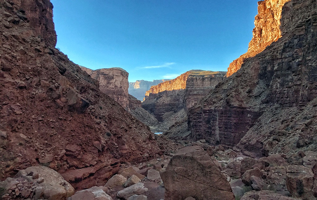
A short and moderate slot canyon, Jackass Canyon requires some mild bouldering and features one major obstacle: a 30-foot drop-off that can be bypassed or often has a rope in place to aid the down-climb. The route begins in a wide and sandy wash but quickly narrows in. Follow the colorful sandstone walls down canyon as you climb, hop and scramble over the various rocks and boulders along the way. As you near the canyon’s end, you will hear the sound of the Colorado River, which comes into view as you cross the boundary into Grand Canyon National Park.

The above-ground view of Jackass Canyon. (Photo Credit: Morgan Sjogren)
Buckskin Gulch
Nearest towns: Fredonia, Arizona and Kanab, Utah
Location: Paria Canyon-Vermilion Cliffs Wilderness
Distance: Approximately 26 miles
Rating: Moderate/Class 3–4
Permits: Required for overnight camping only
At over 15 miles in the canyon itself, this route is typically accomplished in two days spent backpacking but can be done in one big push by strong and adventurous runners. The most common route requires a car shuttle.
Start at Wire Pass, another stunning and narrow canyon, which ends at the confluence of Buckskin Gulch. Buckskin ends at the Paria River Canyon. Continue running upriver to the White House trailhead. Since water levels can vary drastically week to week and seasonally, be prepared to get wet. This can range from deep stagnant pools in Buckskin to a full-on Paria River (check with the BLM Kanab Ranger Station for current conditions). With limited sun exposure, it’s important to pack extra layers even on hot days.
Grand Gulch (Bullet Canyon/Kane Gulch Loop)
Nearest town: Blanding, Utah
Location: Bears Ears National Monument
Distance: 14 miles
Rating: Easy/Class 1
Permits: Overnight only
The crown jewel of Bears Ears National Monument, Grand Gulch is a trail runner’s delight that features flowy singletrack that meanders between Ancestral Puebloan ruins, beneath sandstone towers and along a shallow creek. There are four main entrance points to Grand Gulch, all of which are runnable and can be connected via car shuttle or done as out-and-backs. Take Bullet Canyon to Grand Gulch, then exit via Sheiks Canyon and take the road back to your vehicle for a completely human-powered 14-mile loop.
